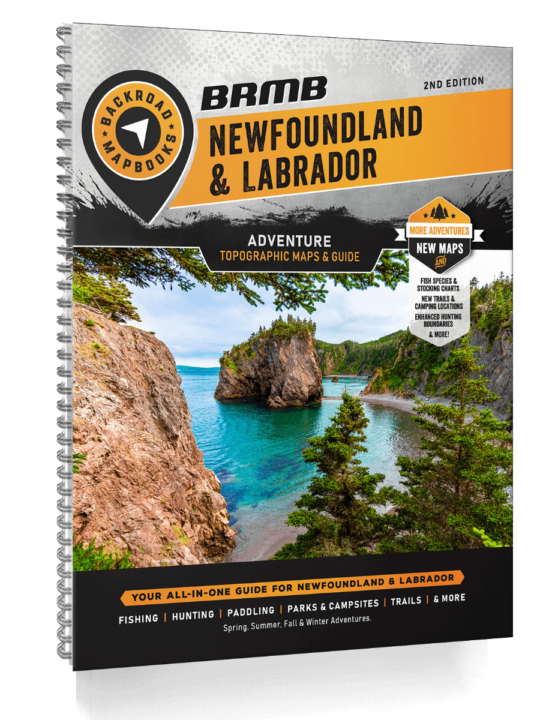
NEWFOUNDLAND & LABRADOR – 2ND EDITION BACKROAD MAPBOOKS
$29.95
Bordered by Quebec to the west and the Labrador Sea to the east and encompassing the island of Newfoundland, the province of Newfoundland and Labrador boasts an impressive landscape that ranges from snow-capped mountains to expansive ocean vistas. The 1,652 m (5,420 ft) Mount Caubvick is the highest point in Canada east of the Rockies, rising sharply from nearby sea level. Gently sloping river valleys and countless lakes dot the landscape, while colourful maritime villages look out over old fishing ports. From the East Coast Trail on the Avalon Peninsula to rugged hiking and biking routes that lead along stunning coastal shorelines, there are countless trail networks to explore. Secluded coves, sandy beaches, waterfalls, and expansive coastal views await road-trippers and backcountry explorers, while rivers, oceans, and ponds offer anglers and paddlers plenty of great destinations.
Description
In the 2nd Edition of the Newfoundland and Labrador Mapbook, we have updated and enhanced all maps including new symbols for readability, expanded and refined road systems, and refined water features with enhanced visibility for scale. We have also added and updated recreation features including updated and expanded trail systems and Multi Use Trail Charts, the addition of Fish Species to the maps, updated and refined ATV and snowmobile route systems, and the addition of new bonus Adventure sections for Snowmobile Huts, Rock Climbing, and Beaches.
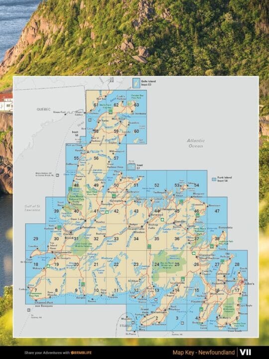
The printed version of the Mapbook comes in the convenient 21.5 x 28 cm (8.5 x 11 inch) mapbook format with a heavy-duty spiral-bound cover. The 192 page book includes 63 maps at 1:250,000 scale and 12 maps at 1:1,000,000 scale, along with 11 Outdoor Adventure Sections, a Service Provider Directory, Map and Adventure Index, Trip Planning Tools, and much more. With over 40,000 kilometres of roads to view including the most complete logging and industrial road coverage available, the books are ideal for navigating on road trips and planning from home.
Print Features
- Map Key & Legend
- Topographic Maps
- 63 @ 1:250,000 Scale Maps
- 12 @ 1:1,000,000 Scale Maps
- Detailed Adventure Section
- Backroad Attractions
- Fishing Locations
- Hunting Areas
- Paddling Routes
- Parks & Campsites
- Trail Systems
- ATV Routes
- Snowmobile Areas
- Wildlife Viewing
- Winter Recreation
- New Bonus Adventures including Beaches, Rock Climbing, and Snowmobile Huts
- Index
- Adventure Index
- Map Index
- Trip Planning Tools
Additional information
| Weight | 1 lbs |
|---|---|
| Dimensions | 11 × 9 × 1 in |
Related products
- Uncategorized11 product
- AluCab22 products
- Awnings11 product
- Camping Supplies5151 products
- Emergency First Aid Kits99 products
- Ground Tents33 products
- JOOLCA66 products
- Merchandise and Apparel66 products
- Nature's Generator33 products
- Navigation66 products
- Off Road Campers11 product
- OK eXpedition11 product
- Recovery Gear1818 products
- Rooftop Tent Accessories55 products
- Rooftop Tents77 products
- Truck Bed Racks33 products
- UGuard11 product

Reviews
There are no reviews yet.